Roksolany – dot on a map with interesting history
Type: Architectural object Kind: Historical
Country: Ukraine Region: Odessa region Locality: Роксолани
Availability: Public, Available for visits, Bad road (during bad weather (rain / snow), can be driven by two-wheel drive cars) , Natural hazard (cliffs / swamps / pits)
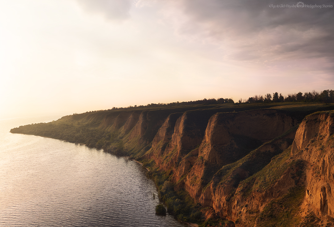
Somehow I came across a “weekend tour” in the village of Roksolany. And I remembered that one of my friends talked about his warm memories of this wonderful place. An initial basic search on the internet did not gave that many results. The village itself is unremarkable, but there are many disputes about the origin of its name and a large number of photos of beautiful clay cliffs above the Dniester estuary.
On the google map, you can see the place where the cliffs should be especially picturesque. So that was the place we went to. On the southeast side of the village, between the clay cliffs and the estuary, there is a strip of shore overgrown with reeds and therefore difficult to pass. There is a road there, but it is uneven and easily gets wet from the slightest rain. There is also an incredible number of insects to add to a picture. On the other side of the village, the clay slopes are higher, with a more pronounced relief and descend directly to the water. You can go down them here, but only by avalanche method – together with a piece of the shore. The slopes are very steep, fragile and collapse regularly.
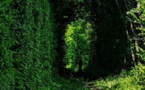
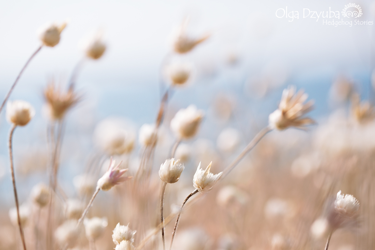
At the top of the banks there is a wonderful aroma of wild steppe herbs. The landscape there is really beautiful. Especially at sunset.
The first trip to Roksolany turned out to be very short – we were caught by a thunderstorm. But later we visited it several more times. And I wanted to find the history of this place after those visits.
There is very little information about the modern village in the internet. For example: “the village of Roksolany was founded in the 1940s. by Ukrainian immigrants and escaped serf peasants, who gave it the name Buzynovate because the area was densely overgrown with tall weeds and bushes (Buzyna (Black elderberry) is Ukrainian name for one the bushes there). The local lord Karol Marchocki, studying the ancient history of the area, established that the Sarmatian tribe “Roksolany” lived here. On his initiative, this sonorous and melodious name was attached to the village.” – this is a sample of a fairly extensive material from the ancient history of the place (excluding the question with ancient city Nikoniy, that was here a long time ago – there is a lot of information about it and a lot of conflicting one).
So, what was found out:
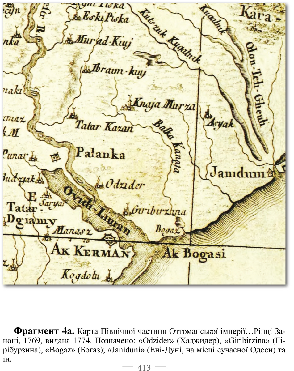
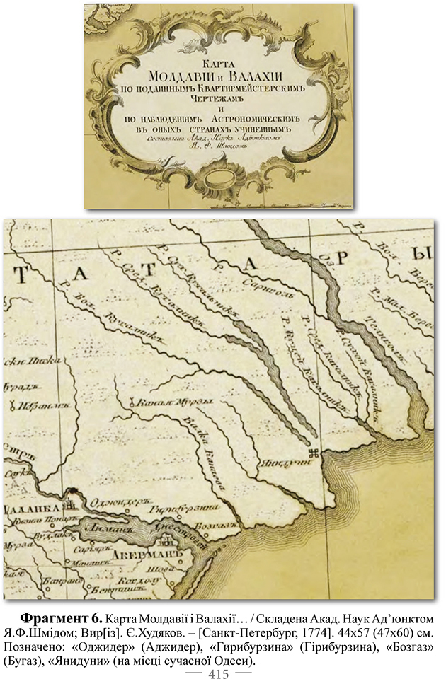
Before the Russo-Turkish war of 1768-1774, there was a settlement of Giriburzyna on the site of the modern village of Roksolany. For the first time, a settlement named Giribirzina was noted in 1774 on two topographic maps of Buzynovate (Giriburzyna, Buzynavody) (I.V. Sapozhnikov//Ovidiopol district. Encyclopedic guide. – Odesa, 2011. – P. 39- 40, Fig. 4, 6.) . This name (in the original Geri boğazına) is translated from the Ottoman-Turkish language as “entrance to the strait”.
The main stages of the history of the settlement of Giriburzyna-Buzynovate are as follows.
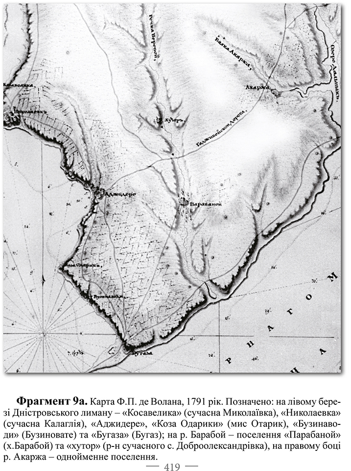
It arose later in the 17th century on lands belonging to Ackerman. The majority of its residents were representatives of the Akkerman district – Christians of Moldavian and Bulgarian origin. In 1791, F.P. de Volan wrote about this from the words of eyewitnesses (and possibly the residents of Hyriburzyna themselves): “Following the banks or, more precisely, the left bank of the estuary in the direction of the confluence of the Dniester, exactly 6 versts [from Aji-Dere] can be found on the slope of the bank and part of a low-lying piece of land 50 fathoms wide, adjacent to the water, the village of Buzynavody. It was large and inhabited by casual Moldavian and Bulgarian fishermen who conducted a lively trade with the goods of their labor. The surroundings and especially the slopes of the banks were previously densely planted with vineyards and orchards. The water in the wells, which can be found at the mouths of the hollow, is excellent.’ The characteristics of the area were supplemented in 1792 by the governor of Katerynoslav V.V. Kakhovsky: “When I examined the ruins of Ajider and the mouth of the Dniester estuary, I found both of these places to be advantageously located. Fertile land, abundant fishing and remnants of destroyed gardens will attract many to live in these places”.
By the way, the presence of Moldovans here could be explained by the find of glazed gray clay pottery in the settlement, which may come from Moldavian pottery centers. It is possible that the inhabitants of Hyryburzyna could have received these ceramics from fellow tribesmen who lived in Akkerman. The fact of Moldovans living in the post of this city (along with Armenians and Greeks) was also recorded in June 1790 by the commandant of the fortress M.I. Kutuzov, who reported that “the local “Voloch” want to move to the left bank of the Dniester estuary to Ajider, Kalaglia and Bugaz.” This desire may have been due to the fact that during the Ottoman period the inhabitants of Akkerman district had orchards, vineyards and fields in these very places, and in 1790 they wanted to return to them. This assumption can be made due to the fact that a significant area of cultivated land, marked along the entire left bank of the estuary, and in places to the Baraboy River on the maps and plans of F.P. de Volan, clearly did not correspond to the degree of its population.
After the arrival of the army of the russian empire in the autumn of 1789, almost the entire population of Giriburzyna left it, partially moving to the village of Kalaglii. In their place came the Cossacks of the Black Sea Army, there were 4 families already here – 8 men and 5 women in July 1791. Around the same time, F.P. de Volan wrote: “Five families of Zaporizhzhya or Black Sea Cossacks have settled here and are engaged in fishing with great success. Poles come to buy the goods of the labor of local residents, and although the fish are sold at such low prices that they get it almost for nothing, and the heads of these few families are cripples, they were successfully enriching.”
Information about the establishment of the village in the 40s of the XIX century. by Ukrainian immigrants and fugitive serfs is most likely a slightly distorted story about the founding of Rufipolis by Count Ignacy Marchocki.
Since 1792, the Buzynovat farmstead has been part of the land of A. M. Hrybovskyi, which was bought in 1802 by Count Ignacy Ścibor Marchocki of Podil.
The subsequent history of the village of Roksolany is very closely connected with this amazing person – Ignacy Ścibor Marchocki and his descendants. He was truly stunning and outstanding (stunning and standing out against the background of the surrounding world in every possible way) because of his views and actions. The story of Ignacy Ścibor Marchocki is interesting and fascinating from beginning to end, but only a small part of it directly connects to the village of Roksolany.
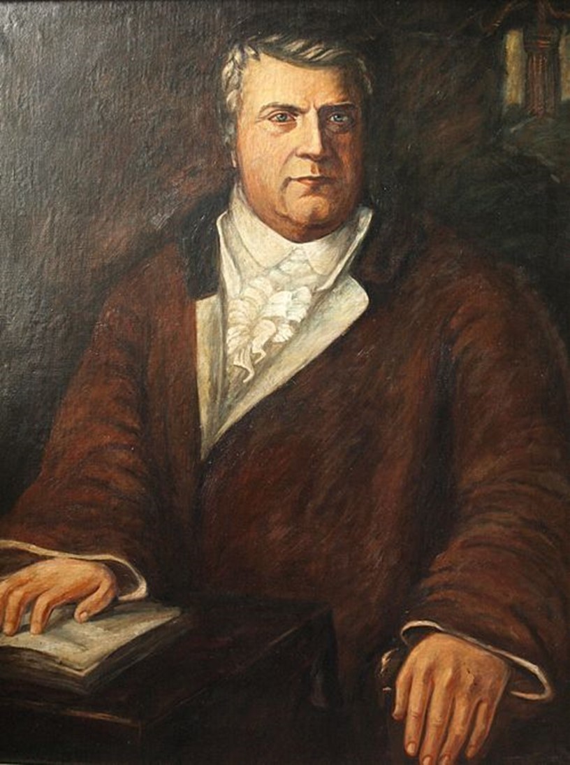
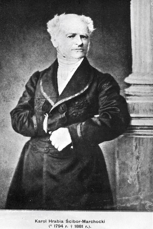
Ignacy Ścibor Marchocki
There are two opinions about the exact period of his life when Ignacy Ścibor Marchocki was influenced by the ideas of Voltaire and Rousseau. This happened either during his service in the Prussian army (where he was sent by his uncle Wojciech Ignacy Ścibor Marchocki for refusing to become a priest) or during his life in Warsaw after his discharge from military service. In addition, while living in Warsaw, Ignatius married Eva Ruffi, the daughter of the royal confectioner. One way or another, he carefully and consistently implemented all these ideas in the Mynkivtsi klyuch estate inherited (with some difficulties) after the death of his uncle, which consisted of about 8,000 morgs ( such a unit of measurement ) of cropland, about 4,000 morgs of forest, the town of Minkivtsi and 18 villages – Mysliborzh, Horodyshche, Katerynivka, Antonivka, Kruzhkivtsi, Otrokiv, Khapanivka, Prytulia, Tymkiv village. Pobiyna), Pobujanka (the village of Pobiyanka), Stary, Syvorogy, Seferivka, Ostoja (now the village of Derzhanivka), with a total population of about 4,200 people.
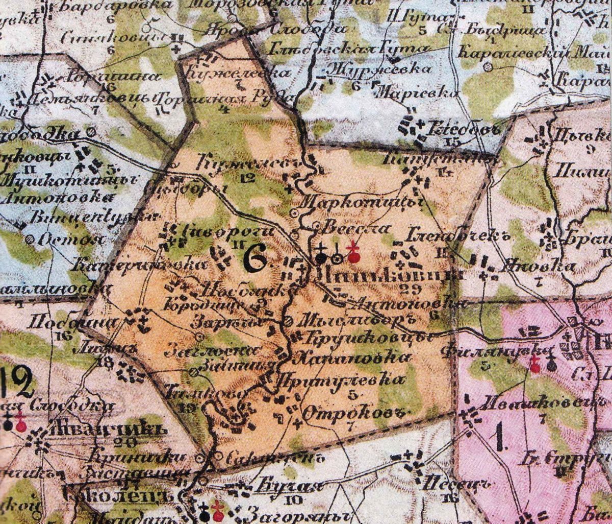
Map of Minsk state
In 1791–1804, Ignacy Ścibor Marchocki “cleansed” the inherited lands of debts and turned them into the “Minkovets State” with its center in Minkovets. Like any state, it had its borders, marked by pillars with the inscription “Border of the Minkovets State from the Russian Empire.” In addition, their own money was issued here for internal consumption, and relations between residents were based on legislative acts created by Marchocki himself. Until 1813, the official Russian imperial authorities did not recognize Ignacy Marchocki ‘s count title. He used the title Dux instead. This title in the meaning “prince” was used by the hetmans of the Zaporizhzhya Army. However, since 1814, after receiving the official privilege of nobility, he added the prefix Re – Redux to it, meaning “returned”, reincarnated, reborn. Ignatius was well versed in Roman law, the works of Plato, and the writings of the French enlighteners. One of the first and most serious steps of Marchocki was to liberate his peasants from serfdom and give them personal freedom. This was stated in a special act solemnly promulgated on January 1, 1795. This act “abolished the lordship and instead introduced the obligation of peasants to pay rent.”
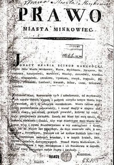
Several times Marchocki and his wife visited resorts in Austria, Saxony and Switzerland. During one of the trips, they visited the Hernghuter colony in Saxony. Marchocki was captivated by their strict customs, the organization of work in manufactories and inspired him to carry out reforms in 1794–1806 in his estates. He formulated the basis of the reforms in the introduction to the act “Dla ułdządzie ziem dziedzicznych ustawy” (“Regulations for the Organization of Inherited Lands”) published in 1796, and the detailed reforms were published on January 2, 1804, in the “Ustawy rolników” (“Law on Farmers”). In addition, he issued many detailed orders, economic and medical advisors and works on the treatment of plague “Sposób leczenia chorujących na zarazę powiertsą, czyli czume…”. For the needs of his state, Marchocki opened his printing house, where statutes, forms, stamp paper, deeds and even literary works were printed. Since 1792, Ye. Moshkova’s Jewish printing house also operated in Minkivtsy (with a break in 1798–1802). In the Minkovets state, management was carried out by the administration, which was appointed by the landowner, and the decisive vote belonged to meetings of representatives of peasant communities, townspeople, Jews and foreigners, who were elected annually. There were two judicial instances: the court (Justiciarium) and the appellate administrative court. The “Law on Farmers” (“Ustawy rolników”) in the Mynkowiec state introduced a tenement system instead of a manor house, provided peasants with ownership of buildings, equipment and gardens, created real opportunities for transition from peasant status to bourgeois and free occupations. According to the will of the owner, rents were low (1 carb. 4 kopecks for every 100 fathoms of land). Severe punishment threatened anyone who would call a subject of Marchocki a slave, a brat or a peasant. Marchocki’s relations with the nobility in his estates were regulated by the “Prawo szlacheckie” (“Nobility Law”, published in 1806), according to which the nobility received land in perpetual lease.
Marchocki founded a school, an orphanage, a hospital, a pharmacy in his possessions, and maintained two doctors. He introduced breeding cattle, organized a stud farm, began breeding mulberry silkworms, and developed sheep breeding. In Minkivtsy, there were carriage factories, bicycle, saltpeter, paper, and varnish manufactories. For the convenience of travelers, Marchocki built a hotel, and ordered the roads to be planted with different varieties of fruit trees. Every year, bread was sent from the county estate on boats down the Dniester to the Black Sea, and wagon rolls were equipped with agricultural and industrial products for numerous trades and fairs.
Unfortunately, in the conditions of the autocratic-serf system of the russian empire, such a phenomenon as the Minkov state with its democratic (or at least constitutional-monarchical) socio-economic system simply had no chance of survival. Even despite the support of the population and the local clergy, Count Marchocki still could not avoid persecution by the ecclesiastical and secular imperial authorities. “For his eccentricities,” wrote the well-known local historian E. I. Sitsynskyi, “especially for the establishment of pagan holidays, Marchocki was tried and even went to prison, but then he was released and died in 1827.”
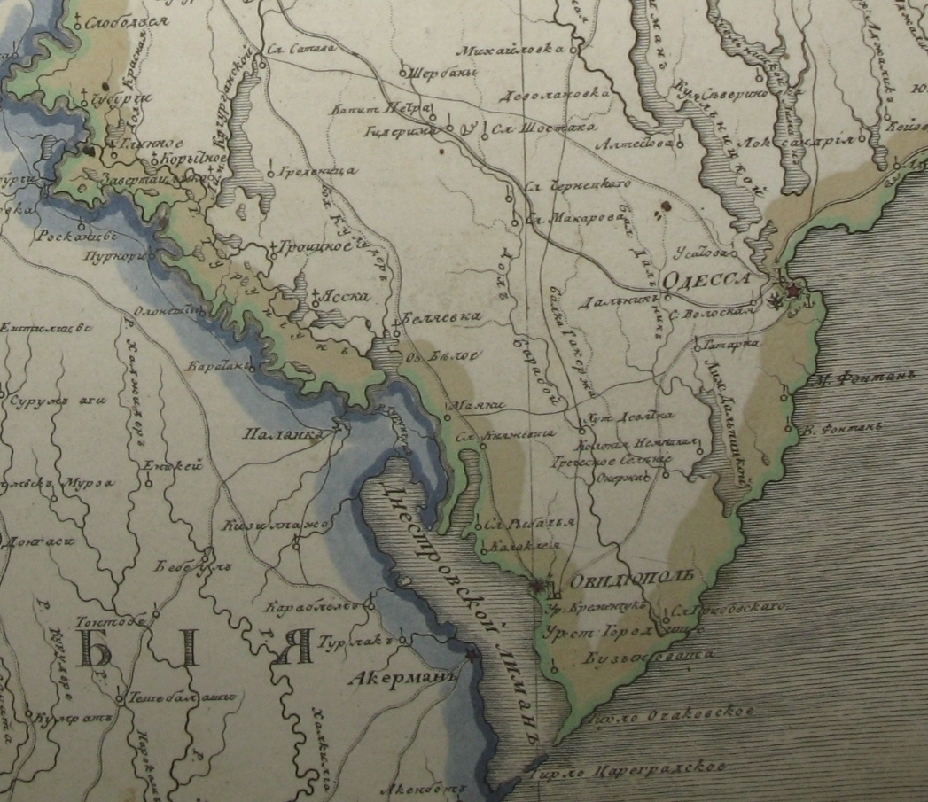
Among the inhabitants of the “wonderful country” there were those who did not like living under such laws, and it became clear that something had to be done with the violators. For this purpose, the count specially arranged penal servitudes. But he decided that they should be different from generally accepted places of punishment. On this occasion, in 1802, Ignacy Marchocki purchased from Hrybovskyi and Altesta near Odesa at a very low price 16 (or 17.5) thousand, acres of steppe with several villages: Hrybivka (Andrianivka), Buzynuvata (Roksolany), Kh. Bilyaivka (Lyubomyla) and Altestovo (Devolanivka). The presence of land in the Kherson province gave Marchocki the right to call himself “heir to the lands above the Euksinsky Pontus.” Subsequently, Karolino (Bugaz), h. Dalnytskyi, the village of Ternovy (now the territory of the Ovidiopol district) and Vyhoda (the modern village of the Bilyaiv district) were formed on two plots. Officially, they were the property of Marchocki ‘s wife and got the name “Ruffypolis county” from her surname. Marchocki developed special provisions for the county and relocated all offenders from Minkivtsy to serve their sentences in resort conditions. Settlers rebuilt villages destroyed during the Russo-Turkish war.
Ignatius Marchocki died in September 1827. His son Karol was going to continue his father’s work, but for his participation in the Polish Uprising of 1831, he was sent to Kursk, and from there – to Siberia. In 1836, the Mynkovets estate was confiscated, and the “wonderful country” ceased to exist – in this territory everything became like in all other places. Rufipolis avoided such a fate. Its lands were divided into four equal parts and passed to each of the count’s four children: Karol Ścibor Marchocki, Emilia (in marriage – Ingistova), Pulcheria (married since 1814 to Eliush Yosypovich Yaksa-Malakhovsky) and Yulia (married since 1823 according to Meliton Yosypovich Yaksa-Malakhovskyi).
The village of Roksolany became the property of Karol Marchocki. Karol inherited his admiration for the ideals of French enlighteners from his father, was an integral part of the Podilsk beaumonde, in particular, a member of the Masonic lodge “Osiris to the Fiery Dawn”, which operated in Kamianets-Podilskyi from 1818 to 1822. In the following years, after the dispersal of the Podil masons, the life of the young count was closely connected with the Black Sea region (he had no particular choice due to the noticeable dissatisfaction of the state imperial machine with his views on the surrounding world and its system). In 1824, he assisted botanist A. L. Andrzejevskii, who together with K. Monyushko collected plant collections in the south of Ukraine. Despite the risk of imprisonment, Karol Marchocki helped various disgraced cultural figures. At the end of the 1840s, K. Marchocki supported the archaeologist P. V. Becker, who aimed to find the remains of the ancient Greek Ophius in the Baraboy delta. Moreover, there is a version that under the impression of archaeological activity in honor of the Roksolany tribe, Karol renamed the village of Buzynuvate to Roksolany. Another version: for the first time the name of Roksolany is indicated in the will of I. Ścibor-Marchocki dated December 14, 1822. What could be the reasons – it was not possible to be found. In the documents of the Russian Empire, the name Roksolany was used only from 1856, and the metric books of the Ovidiopol Cathedral Church of St. Nicholas record the change of the name of Buzynuvaty settlement to Roksolany from the beginning of 1859.
From all these data, it is difficult to draw an unequivocal conclusion about who exactly – the father or the son of Marchocki came up with the idea of renaming the village to Roksolany, for what reason and in what specific year.
As with the modern name of the village of Roksolany, there is no clarity about the origin of the name of Roksolany’s ancient neighbor – Niconii. When I was looking for preliminary information about Niconii, I couldn’t find the coordinates so easily, but I managed to calculate from satellite images where it should be. On the spot, it turned out that apart from a sign with the information that “somewhere around you now are the ruins of the ancient city of Niconii” and grassy earth ditches and mounds, you can only look at the beautiful sky and birds. There was no archaeological activity at the time of our visit (2021), and there is a lot of information on the Internet that “black archaeologists” kicked out (literally, apparently) some number of years ago an official expedition.
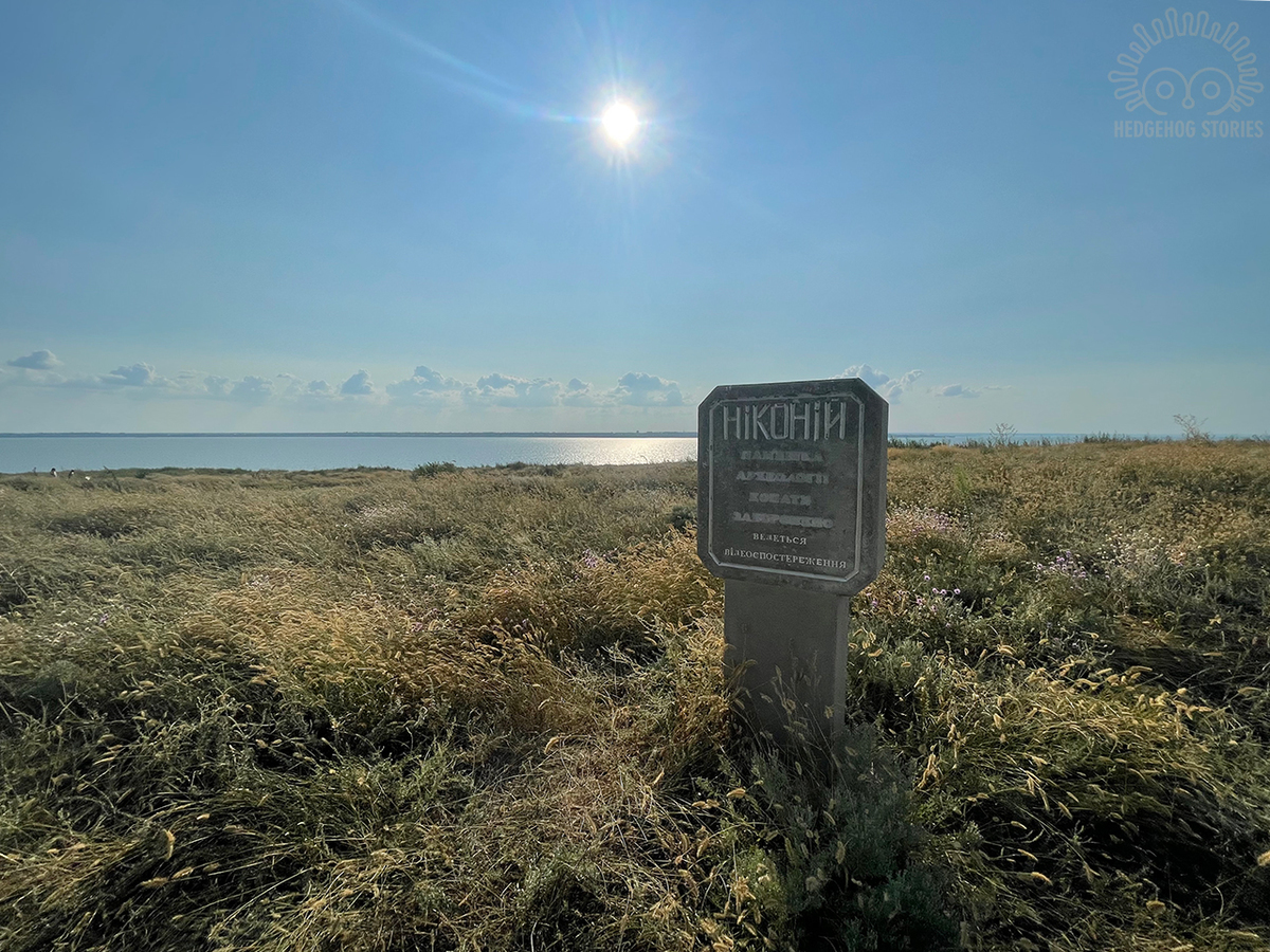
That’s all that reminds of ancient Niconii
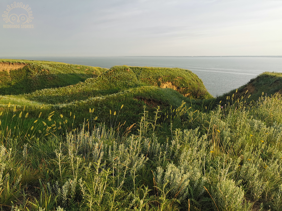
Landscape on the site of the ancient city
Niconii
Niconii is mentioned in the works of ancient Greek authors: in the Periplus of Pseudo-Skymen, the “Geographies” of Strabo and Ptolemy. In the XIV-XVI centuries. the ruins of ancient settlements were described by travelers who tried to connect what they saw with the evidence of ancient authors.
According to one version, Niconii was founded by immigrants from Ionia in the last third of the 6th century. BC. It was a small polis consisting of the city itself and about a dozen left-bank rural settlements with dugout buildings. In the northwestern part of the settlement, on the narrow part of the coastal promontory, a 5 m long ditch with even slopes was discovered, dated to the second half of the 5th – the first half of the 4th centuries. B.C. The wall was probably located on the western side of the moat, the remains of a 2.5 m wide adobe foundation have been preserved from it. In the second half of the IV century. B.C. the wall stopped performing its protective function. At the end of the 4th or the beginning of the 3rd century B.C. it was dismantled, the moat filled in, and in the first centuries AD the plot was built up with residential buildings. Two types of premises are characteristic of the early Niconii – ground houses with mud walls and adobe roofs, and rectangular semi-earthen buildings, sunk into the ground by 0.5 m, with a furnace and a blower. Stone construction in Niconii began in the 5th century. B.C. and in the IV century B.C. already had a regular place. Residential complexes with several rooms with basements were built along the streets. In the southwestern part of the settlement, a street paved with pebbles and broken ceramics 3.5 m wide was discovered, which functioned during the V-IV centuries. BC. A house with an area of 200 sq.m. faces this street; a house from the first centuries of our era (area 120 sq. m.), which was destroyed in a fire somewhere in the III century, was discovered there. Four children’s burials in amphorae were found in one of the premises of this building. Thin-walled imported ceramics and molded, mainly Scythian ware were found in the early cultural layers of Niconii, and in the later ones there are remains of Gettic basins and pots. A large part of the finds are Ionian and Attic terracotta statuettes of the goddess on a throne, seated next to Silenus or a Satyr. Many grain pits and iron sickles were discovered. To the east of the hillfort was a burial mound of the 4th century. B.C.
It is believed that Niconii could have been a part of the Athenian Naval Union as a result of the Pericles squadron’s campaign to the Northern Black Sea coast. Agriculture was the basis of Niconii’s economy. Niconii traded with the cities of Ionia, Antiquity, insular Greece, as well as the centers of the South, West and North-West Black Sea coasts, especially with Istria and Olbia. In the VI-V century B.C. Niconii did not mint his own coin, and calculations were made with cast Istrian coins. Coins of other ancient centers are much less used. In the V-IV centuries. B.C. coins of Olbia, Tyra, and Apollonia appeared in small quantities. Niconii also issued coins itself, imitating the Istrian “wheels”, along with the imitation, the city minted its own coins of three denominations with an owl and the inscription (legend) ΣΚΥ,ΣΚ, ΣΚΥΛ (SKAY, SK, SKAYL), which are dated from 450-475 B.C. Most likely, it relates to the name of the Scythian king Scylla, there are also a number of other artifacts and information that indicate that the Scythian king was connected with the city and the minting of coins, but this is still not proven finally.
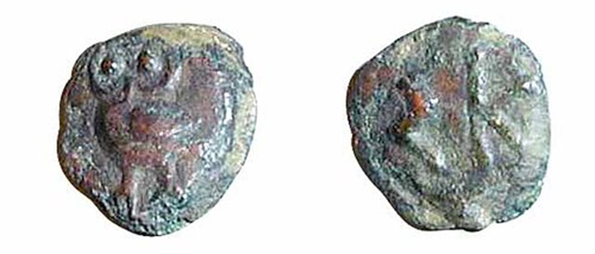
Coins from Niconii
Most sources agree that the period of Niconii’s heyday falls on the V-IV centuries. B.C. At this time, defensive structures were also built. But in the first quarter of the 5th century B.C. rural settlements cease to exist (as in Nizhny Pobuzhzhia). Most likely, this related to the campaign of Zopyrion (the general of Alexander the Great) against the Scythians, or with the advance of King Atheus to Dobruja. The new settlement of the outskirts of Niconii took place only in the 4th–3rd centuries. B.C. but, according to researchers, the new inhabitants of the rural district were mostly “barbarians”. In the III-II centuries B.C. the decadence intensifies, and with the influx of Golats and other tribes, the city finally perishes.
In the first centuries of the new era, life in Niconiiwas restored, its boundaries expanded to the south by almost 1 ha. The remains of defensive structures of this time have been recorded, although they are less powerful than in the previous period. The houses were ground multi-chamber structures, the adobe walls of which were built on stone foundations. The city remained a major trade center of the region. Products from Sinope, Pergamum, Samos, Syria, Palestine, Egypt, and the western provinces of the Roman Empire arrived here. Niconii ceased to exist in the middle of the 3rd century A.D. during the Scythian Wars.
Unfortunately, at this time, only insects and steppe grasses can be observed at the Niconii site.
Source 1, 2, 3, 4, 5, 6, 7, 8, 9, 10, 11, as well as Encyclopedic publication Ukraine: Chronology of Development / National Academy of Sciences of Ukraine. Institute of History of Ukraine. – Volume 4. – K.: KRION, 2009. – 608 p.: illustrations.